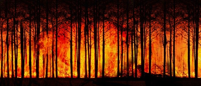
Waldbrände und Klimawandel – ein schwieriges Thema. Klimaaktivisten neigen dazu, jeden größeren Waldbrand alarmistisch dem Klimawandel anzulasten. Wärmeres Klima, daher mehr Waldbrände, lautet der Slogan. Allerdings ist Trockenheit viel entscheidender, und da gibt es weltweit in den letzten 100 Jahren keinen einheitlichen Trend. Zudem muss es einen Auslöser der Brände geben. Eine natürliche Quelle sind Blitze. Allerdings sind die meisten Waldbrände heutzutage wohl auf unachtsamen Umgang mit Feuer sowie Brandstiftung zurückzuführen. Da es heute viel mehr Menschen gibt als früher, gibt es auch viel mehr Unachtsame und Verrückte. Wir schauen heute, was es Neues zum Thema gibt.
Eine globale Studie von Andela et al. 2017 dokumentierte auf Basis von Satellitenbildern, dass die verbrannte Fläche in den letzten 18 Jahren um 25% zurückgegangen ist. Ursache ist u.a. die Ausdehnung der Landwirtschaft und die Abkehr von fruchtbarkeitssteigernden Feuern in Savannen. Klimamodelle können den Rückgang der Brände nicht reproduzieren, scheinen also wichtige Einflussgrößen zu übersehen. Insofern sind auch die auf ihrer Basis erstellten Waldbrandprognosen für die Zukunft nicht verlässlich. Abstract:
A human-driven decline in global burned area
Fire is an essential Earth system process that alters ecosystem and atmospheric composition. Here we assessed long-term fire trends using multiple satellite data sets. We found that global burned area declined by 24.3 ± 8.8% over the past 18 years. The estimated decrease in burned area remained robust after adjusting for precipitation variability and was largest in savannas. Agricultural expansion and intensification were primary drivers of declining fire activity. Fewer and smaller fires reduced aerosol concentrations, modified vegetation structure, and increased the magnitude of the terrestrial carbon sink. Fire models were unable to reproduce the pattern and magnitude of observed declines, suggesting that they may overestimate fire emissions in future projections. Using economic and demographic variables, we developed a conceptual model for predicting fire in human-dominated landscapes.
Hier die dazugehörige Pressemitteilung der NASA:
NASA Detects Drop in Global Fires
Shifting livelihoods across the tropical forest frontiers of South America, the Eurasian Steppe, and the savannas of Africa are altering landscapes and leading to a significant decline in the amount of land burned by fire each year, a trend that NASA satellites have detected from space. The ongoing transition from nomadic cultures to settled lifestyles and intensifying agriculture has led to a steep drop not only in the use of fire on local lands, but in the prevalence of fire worldwide, researchers at NASA’s Goddard Space Flight Center in Greenbelt, Maryland, and colleagues found.
Globally, the total acreage burned by fires each year declined by 24 percent between 1998 and 2015, according to a new paper in Science that analyzes NASA’s satellite data, as well as population and socioeconomic information. The decline in burned lands was largest in savannas and grasslands, where fires are essential for maintaining healthy ecosystems and habitat conservation.
Across Africa, fires typically burn an area about half the size of the continental United States every year, said Niels Andela, a research scientist at Goddard and lead author on the paper. In traditional savanna cultures with common lands, people often set fires to keep grazing lands productive and free of shrubs. As many of these communities have shifted to cultivate more permanent fields and to build more houses, roads and villages, the use of fire declines. As economic development continues, the landscape becomes more fragmented, communities often enact legislation to control fires and the burned area declines even more.
By 2015, savanna fires in Africa had declined by 270,000 square miles (700,000 square kilometers) — an area the size of Texas. “When land use intensifies on savannas, fire is used less and less as a tool,” Andela said. “As soon as people invest in houses, crops and livestock, they don’t want these fires close by anymore. The way of doing agriculture changes, the practices change, and fire slowly disappears from the grassland landscape.”
Andela and an international team of scientists analyzed the fire data, derived from the Moderate Resolution Imaging Spectrometer (MODIS) instruments on NASA’s Terra and Aqua satellites, as well as other sources. They compared these datasets with trends in population, agriculture, livestock density and gross domestic product.
The scientists found a different pattern in the rainforests and other humid regions close to the equator. Natural fires are rare in tropical forests, but as people settle an area they often burn to clear land for cropland and pastures. After the land is first cleared, as more people move into the area and increase the investments in agriculture, they set fewer fires and the burned area declines again.
The impact of human-caused changes in savannas, grasslands and tropical forests is so large that it offsets much of the increased risk of fire caused by warming global temperatures, said Doug Morton, a research scientist at Goddard and a co-author of the study. Still, the impact of a warming and drying climate is seen at higher latitudes, where fire has increased in parts of Canada and the American west. Regions of China, India, Brazil and southern Africa also show an increase in burned area. But the expansiveness of savannas and grasslands puts the global trend in decline.
“Climate change has increased fire risk in many regions, but satellite burned area data show that human activity has effectively counterbalanced that climate risk, especially across the global tropics,” Morton said. “We’ve seen a substantial global decline over the satellite record, and the loss of fire has some really important implications for the Earth system.”
Fewer and smaller fires on the savanna favors trees and shrubs instead of open grasslands, altering habitat for the region’s iconic mammals, like elephants, rhinoceroses and lions. “Humans are interrupting the ancient, natural cycle of burning and regrowth in these areas,” senior author Jim Randerson, a professor of Earth system science at the University of California, Irvine, said of the African savannas. “Fire had been instrumental for millennia in maintaining healthy savannas, keeping shrubs and trees at bay and eliminating dead vegetation.”
There are benefits to fewer fires as well. Regions with less fire also saw a drop in carbon monoxide emissions and an improvement in air quality during the peak of the fire season, confirming the burned area trends using data from other NASA satellites. With less fire, the vegetation in savannas is also able to build up — taking up carbon dioxide from the atmosphere, instead of releasing it into the atmosphere during fires. The 24 percent decline in burned area may have contributed about 7 percent to the ability of global vegetation to absorb the increase in carbon dioxide emissions from burning fossil fuels and land use change.
The decline in burned area from human activity raises some difficult questions, Morton said: “For fire-dependent ecosystems like savannas, the challenge is to balance the need for frequent burning to maintain habitat for large mammals and biodiversity, while reducing fire on the landscape to improve air quality and protect people’s property and agriculture.” As these savannas and grasslands continue to develop and agriculture intensifies, however, the researchers expect the global decline in fires to continue. It’s a trend that should be incorporated into computer models that forecast climate and carbon dynamics, Morton said. “The loss of fire from agricultural landscapes has a big impact on communities and ecosystems. Looking ahead, models that account for changes in fire activity from human management will help us understand the feedbacks from fewer fires on vegetation, air quality and climate,” he said.
Stefan Doerr und Cristina Santin von der Swansea University haben globale Waldbrandtrends ausgewertet (Doerr & Santin 2016). Ähnlich wie ihre NASA Kollegen konnten sie einen Rückgang der verbrannten Fläche feststellen. Zudem zeigte sich dass es heute weniger Brände gibt als in den Jahrhunderten zuvor. Abstract:
Global trends in wildfire and its impacts: perceptions versus realities in a changing world
Wildfire has been an important process affecting the Earth’s surface and atmosphere for over 350 million years and human societies have coexisted with fire since their emergence. Yet many consider wildfire as an accelerating problem, with widely held perceptions both in the media and scientific papers of increasing fire occurrence, severity and resulting losses. However, important exceptions aside, the quantitative evidence available does not support these perceived overall trends. Instead, global area burned appears to have overall declined over past decades, and there is increasing evidence that there is less fire in the global landscape today than centuries ago. Regarding fire severity, limited data are available. For the western USA, they indicate little change overall, and also that area burned at high severity has overall declined compared to pre-European settlement. Direct fatalities from fire and economic losses also show no clear trends over the past three decades. Trends in indirect impacts, such as health problems from smoke or disruption to social functioning, remain insufficiently quantified to be examined. Global predictions for increased fire under a warming climate highlight the already urgent need for a more sustainable coexistence with fire. The data evaluation presented here aims to contribute to this by reducing misconceptions and facilitating a more informed understanding of the realities of global fire.
Auch Earl & Simmonds 2018 fanden auf Basis von Satellitenbildauswertungen einen Rückgang der Wald- und Buschbrandschäden in den letzten anderthalb Jahrzehnten. Die Hauptursachen sind eine Zunahme der primären Vegetationsproduktivität im nördlichen Afrika sowie die Ausweitung und Intensivierung der weltweiten Landwirtschaft. Abstract:
Spatial and Temporal Variability and Trends in 2001–2016 Global Fire Activity
Fire regimes across the globe have great spatial and temporal variability, and these are influence by many factors including anthropogenic management, climate, and vegetation types. Here we utilize the satellite‐based “active fire” product, from Moderate Resolution Imaging Spectroradiometer (MODIS) sensors, to statistically analyze variability and trends in fire activity from the global to regional scales. We split up the regions by economic development, region/geographical land use, clusters of fire‐abundant areas, or by religious/cultural influence. Weekly cycle tests are conducted to highlight and quantify part of the anthropogenic influence on fire regime across the world. We find that there is a strong statistically significant decline in 2001–2016 active fires globally linked to an increase in net primary productivity observed in northern Africa, along with global agricultural expansion and intensification, which generally reduces fire activity. There are high levels of variability, however. The large‐scale regions exhibit either little change or decreasing in fire activity except for strong increasing trends in India and China, where rapid population increase is occurring, leading to agricultural intensification and increased crop residue burning. Variability in Canada has been linked to a warming global climate leading to a longer growing season and higher fuel loads. Areas with a strong weekly cycle give a good indication of where fire management is being applied most extensively, for example, the United States, where few areas retain a natural fire regime.
Eiszeitliche Jäger haben wohl in Europa regelmäßig Brände gelegt, wie die Universität Leiden 2016 per Pressemitteilung bekanntgab:
Ice Age hunters destroyed forests throughout Europe
Large-scale forest fires started by prehistoric hunter-gatherers are probably the reason why Europe is not more densely forested. This is the finding of an international team, including climate researcher Professor Jed Kaplan of the University of Lausanne and archaeologist Professor Jan Kolen of Leiden University. Publication on 30 November in PLOS ONE.
Deliberate or negligent
This research has generated new insights on the role of hunters in the formation of the landscape. It may be that during the coldest phase of the last Ice Age, some 20,000 years ago, hunter-gatherers deliberately lit forest fires in an attempt to create grasslands and park-like forests. They probably did this to attract wild animals and to make it easier to gather vegetable food and raw materials; it also facilitated movement. Another possibility is that the large-scale forests and steppe fires may have been the result of the hunters‘ negligent use of fire in these semi-open landscapes.
Large-scale impact of humans on landscape
The researchers combined analyses of Ice Age accumulations of silt and computer simulations with new interpretations of archaeological data. They show that hunters throughout Europe, from Spain to Russia, were capable of altering the landscape. This first large-scale impact of humans on landscape and vegetation would have taken place more than 20,000 years before the industrial revolution. The Ice Age is often presented as an era of extreme cold and snow that was ruled by mammoths, bison and giant bears. But the researchers show that humans were also capable of having a significant impact on the landscape.
Layers of ash
Searching for evidence of this human impact explains why there are conflicting reconstructions for this period. Reconstructions of the vegetation based on pollen and plant remains from lakes and marshland suggest that Europe had an open steppe vegetation. But computer simulations based on eight possible climate scenarios show that under natural conditions the landscape in large areas of Europe would have been far more densely forested. The researchers conclude that humans must have been responsible for the difference. Further evidence has been found in the traces of the use of fire in hunting settlements from this period and in the layers of ash in the soil.
Previous Leiden research already suggested human intervention
The team from Lausanne was made up of climate researchers and ecologists Jed Kaplan, Mirjam Pfeiffer and Basil Davis. Archaeologists Jan Kolen and Alexander Verpoorte from Leiden University also worked on the research. An earlier publication by Leiden’s Human Origins research group, that was published in Current Anthropology, had already suggested that hunter-gatherers from the Stone Age may well have modified the natural environment considerably through their use of fire. The new publication in PLOS ONE confirms this hypothesis and may be one of the earliest examples of large-scale human impact on the landscape throughout the whole of Europe.
Paper: Jed O. Kaplan, Mirjam Pfeiffer, Jan C. A. Kolen, Basil A. S. Davis. Large Scale Anthropogenic Reduction of Forest Cover in Last Glacial Maximum Europe. PLOS ONE, 2016; 11 (11): e0166726 DOI: 10.1371/journal.pone.0166726
Eine Waldbrand-Eiszeit-Geschichte brachte 2017 auch die University of Montreal. Hier die Pressemitteilung (via Science Daily). Waldbrände während der Kälte der Eiszeit zeigen, dass es kaum auf die Temperatur ankommt, sondern vor allem auf Trockenheit und das Vorhandensein von „Treibstoff“, also Bäume und Sträucher.
Forest fires are not limited to hot or temperate climates
There were wildfires in the Alps during an ice age 20,000 years ago
Evidence of wildfires dating back 20,000 years was recently discovered in the Massif du Queyras, in the heart of the French Alps, 2,240 meters above sea level. This discovery echoes the recent wildfires in the Arctic tundra, where the presence of trees have become increasingly common.
Forest fires and wildland fires are common in summer in the temperate boreal forest, rarer at high altitudes, and unheard of in an ice age at high altitudes — until now. Evidence of wildfires dating back 20,000 years was recently discovered in the Massif du Queyras, in the heart of the French Alps, 2,240 metres above sea level. The news comes in a joint Canada-France study published in New Phytologist and co-authored by Olivier Blarquez, a geography professor at Université de Montréal, and Christopher Carcaillet, a professor at the École Pratique des Hautes Études, in Paris, and at the Laboratoire d’écologie des hydrosystèmes naturels et anthropisés (CNRS/Université Lyon 1/ENTPE).
„This discovery is not trivial,“ said Blarquez. „It echoes the recent wildfires in the Arctic tundra, where [the presence of] trees have become increasingly common. The situation has drawn the attention of the scientific community because of its significant impact on the [Earth’s] carbon cycle. Changes in high mountain forest cover due to global warming, and especially the abandonment of agricultural land, risk exacerbating the spread of wildfires in the coming years.“
In their study, Blarquez and Carcaillet reconstruct wildland fire frequency and forest composition over the past 20,000 years, including the Last Glacial Maximum, when ice sheets were at their greatest extension. The researchers‘ findings suggest there was a tree glacial refugium during this period, when wildfires were able to break out. The authors also consider the complex long-term interactions between fires, vegetation and climate.
„Wildfires spread when fuel is available and the climate is dry,“ said Carcaillet, who is also co-director of the Laboratoire international associé franco-canadien MONTABOR.
„It is therefore counterintuitive to imagine wildland fires in periglacial, subpolar or mountain areas. And yet [the discovery of] high mountain lacustrine sediments revealed just that. Wildfires were indeed rare, but the presence of wood charcoal confirmed that they did occur, even during glacial and postglacial periods.“
High mountain wildfires: Swiss stone pines, larches among the causes
Wildfires occurred in the Massif du Queyras, situated between France and Italy, because the trees survived the ice age. Evidence of their existence has been found in macro-remains such as leaves and seeds. However, a second area located further north, in the Massif de la Vanoise (Auvergne-Rhône-Alpes) where sediment accumulated during the Last Glacial Maximum, shows no trace of vegetation. No evidence of wildfires was found in this area, because without vegetation to burn, fire couldn’t spread.
In the Queyras, Swiss stone pines and larches formed an isolated tree glacial refugium, „like an island in the middle of an ocean of ice,“ according to the study. Protected during the Last Glacial Maximum, these trees could be the genetic ancestors of the Swiss stone pines and larches that still grow in the valleys of the Western Alps. As the dominant forest cover changed, fires began to happen. In the early Holocene Epoch (about 10,700 years ago), the climate became warmer and more humid; the Swiss stone pine, dominant in areas with low fire frequencies during the ice age (when the climate was cold and dry), was replaced by the larch, which coincided with increased fire frequencies.
„This study demonstrates that a periglacial climate does not preclude wildfires,“ said Carcaillet. „Trees — in this case, Swiss stone pines — are necessary for fires to burn in high mountains. The climate affects the frequency of fires, and in return, fires affect tree diversity.“
Paper: Christopher Carcaillet, Olivier Blarquez. Fire ecology of a tree glacial refugium on a nunatak with a view on Alpine glaciers. New Phytologist, 2017; DOI: 10.1111/nph.14721
Ein Paper von Feurdean et al. 2013 befasst sich mit der Waldbrandgeschichte in Transylvanien während der vergangenen 12.000 Jahre. Selten waren Feuer so selten wie heute.