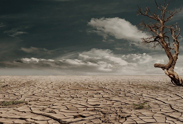
Wasser bedeutet Leben. Wenn der Regen länger ausbleibt, entwickeln sich Dürren, die den Menschen zu schaffen machen. Einige Protagonisten der Klimadebatte stellen nahezu jede Dürre als Folge des Klimawandels dar. Dabei übersehen sie, dass man zunächst überprüfen sollte, ob das Dürregeschehen überhaupt bereits die Schwankungsbreite der natürlichen Klimavariabilität verlassen hat. In diesem Beitrag schauen wir, was es Neues zu diesem spannenden Thema gibt. Gibt es Muster, die uns bei der Dürrevorhersage helfen könnten? Welche Trends werden beobachtet.
Wir beginnen in den USA. Baek et al. 2021 untersuchten die Westküste der USA und stellen fest, dass in den allermeisten Fällen (84%) kein Einfluss der Pazifischen Ozeanzyklen auf die gleichzeitig in Washington, Oregon und Kalifornien auftretenden Dürren festzustellen ist. Abstract:
U.S. Pacific Coastal Droughts Are Predominantly Driven by Internal Atmospheric Variability
Droughts that span the states of Washington, Oregon, and California are rare but devastating due to their large spatial coverage and potential loss of redundancies in water, agricultural, and fire-fighting resources. Such pan-coastal droughts [which we define using boreal summer volumetric soil moisture along the U.S. Pacific coast (32°–50°N, 115°–127°W)] require a more precise understanding of the roles played by the Pacific Ocean and internal atmospheric variability. We employ 16-member ensembles of the Community Atmosphere Model version 5 and Community Climate Model version 3 forced with observed sea surface temperatures (SSTs) from 1856 to 2012 to separate and quantify the influences of the tropical Pacific and internal atmospheric variability on pan-coastal droughts; all other boundary conditions are kept at climatological levels to explicitly isolate for the impacts of SST changes. Internal atmospheric variability is the dominant driver of pan-coastal droughts, accounting for 84% of their severity, and can reliably generate pan-coastal droughts even when ocean conditions do not favor drought. Cold phases of the Pacific Ocean play a secondary role and contribute, on average, only 16% to pan-coastal drought severity. Spatiotemporal analyses of precipitation and soil moisture along the U.S. Pacific coast corroborate these findings and identify an antiphased wet–dry dipole pattern induced by the Pacific to play a more secondary role. Our model framework expands on previous observational analyses that point to the spatially uniform forcing of internal atmospheric variability as the more dominant mode of hydroclimate variability along the U.S. Pacific coast. The secondary nature of oceanic forcing suggests limited predictability of pan-continental droughts.
Siehe auch Bericht auf Notrickszone.
In einzelnen Gebieten der US-Westküste spielt der Pazifik mit El Nino – La Nina und der Pazifischen Dekadenoszillation (PDO) aber doch eine Rolle, wie aus einer Pressemitteilung der University of Washington 2019 hervorgeht:
How the Pacific Ocean influences long-term drought in the Southwestern U.S.
The Southwest has always faced periods of drought. Most recently, from late 2011 to 2017, California experienced years of lower-than-normal rainfall.
El Niño is known to influence rain in the Southwest, but it’s not a perfect match. New research from the University of Washington and the Woods Hole Oceanographic Institution explores what conditions in the ocean and in the atmosphere prolong droughts in the Southwestern U.S. The answer is complex, according to a study published Aug. 6 in the Journal of Geophysical Research: Atmospheres, a journal of the American Geophysical Union. “What causes droughts that last for decades in some parts of the world, and why does that happen? Can we predict it?” said first author Luke Parsons, a UW postdoctoral researcher in atmospheric sciences. “Our study shows that when you have a large El Niño event, and a La Niña event is coming next, that could potentially start a multiyear drought in the Southwestern U.S.”
The general rule of thumb had been that El Niño years — when the sea surface in a region off the coast of Peru is at least 1 degree Celsius warmer than average — tend to have more rainfall, and La Niña years, when that region is 1 degree Celsius cooler than average, tend to have less rain. But that simple rule of thumb doesn’t always hold true. “People often think that El Niño years are wet in the Southwest, but research over the years shows that’s not always the case,” Parsons said. “An El Niño sometimes brings rain, or can help cause it, but frequently that’s not what makes any given year wet.”
The recent 2015 winter was a case in point, and Parsons said that event helped inspire the new study. As 2015 shaped up to be an El Niño year, there was hope that it would end California’s drought. But the rain didn’t start to arrive until the following year. The new study uses climate models to explore the relationship between the world’s largest ocean and long-term droughts in the Southwestern U.S., which includes California, Nevada, Utah, Arizona and western Colorado and New Mexico. “When it’s dry one year after another, that’s hard on people, and it can be hard on ecosystems,” Parsons said.
Weather observations for the Southwest date back only about 150 years, and in that time, only 10 to 15 multiyear droughts have occurred. So the authors used climate models that simulate thousands of years of weather, including over 1,200 long-term droughts in the Southwest. The authors defined a drought as multiple years with lower-than-average rainfall. The drought ended when the region had two consecutive wetter-than-normal years. “A lot of people have looked at what’s going on over the ocean during a drought, but we’re trying to take a step back, and look at the whole life cycle — what happens before a drought starts, what maintains a drought, and then what ends it,” Parsons said.
Parsons and co-author Sloan Coats at the Woods Hole Oceanographic Institution separated the system into pre-drought, during-drought and post-drought periods. They found that before a long-term drought starts, there is often an El Niño year. Then the first year of a drought is often colder than normal in that region of the ocean, though it might not be enough to qualify as a La Niña year. “Where that warm pool of water sits ends up disturbing, or changing, the jet stream, and that shifts where the winter rains come in off the ocean in the Northern Hemisphere winter,” Parsons said. “La Niña can kick off a drought, but you don’t have to have multiple La Niña events to continue the drought and keep the Southwest dry.”
An El Niño that’s slightly farther offshore than normal, in the central tropical Pacific, often ends the drought. But the study shows that’s not always true: About 1 in 20 drought years could see an El Niño that doesn’t deliver rain. Better understanding of long-term droughts could help managers make decisions like whether to release water from the Colorado River, or whether to save some in anticipation of another low year. The study was funded by the Washington Research Foundation. Weather data and climate model results came from the National Science Foundation, the National Oceanic and Atmospheric Administration and the U.S. Department of Energy.
Paper dazu: Parsons & Coats 2019
Im Südwesten der USA treten immer wieder Phasen längerer und schwerer Dürren auf, sogenannte Mega-Dürren. Steiger et al. 2019 haben sie dokumentiert:
Oceanic and radiative forcing of medieval megadroughts in the American Southwest
Multidecadal “megadroughts” were a notable feature of the climate of the American Southwest over the Common era, yet we still lack a comprehensive theory for what caused these megadroughts and why they curiously only occurred before about 1600 CE. Here, we use the Paleo Hydrodynamics Data Assimilation product, in conjunction with radiative forcing estimates, to demonstrate that megadroughts in the American Southwest were driven by unusually frequent and cold central tropical Pacific sea surface temperature (SST) excursions in conjunction with anomalously warm Atlantic SSTs and a locally positive radiative forcing. This assessment of past megadroughts provides the first comprehensive theory for the causes of megadroughts and their clustering particularly during the Medieval era. This work also provides the first paleoclimatic support for the prediction that the risk of American Southwest megadroughts will markedly increase with global warming.
Dazugehörige Pressemitteilung des Earth Institute at Columbia University:
Climate change could revive medieval megadroughts in US Southwest
Study picks apart factors that caused severe, long-lasting droughts and suggests increased risk for future
About a dozen megadroughts struck the American Southwest during the 9th through the 15th centuries, but then they mysteriously ceased around the year 1600. What caused this clustering of megadroughts — that is, severe droughts that last for decades — and why do they happen at all?
If scientists can understand why megadroughts happened in the past, it can help us better predict whether, how, and where they might happen in the future. A study published today in Science Advances provides the first comprehensive theory for why there were megadroughts in the American Southwest. The authors found that ocean temperature conditions plus high radiative forcing — when Earth absorbs more sunlight than it radiates back into space — play important roles in triggering megadroughts. The study suggests an increasing risk of future megadroughts in the American Southwest due to climate change.
Previously, scientists have studied the individual factors that contribute to megadroughts. In the new study, a team of scientists at Columbia University’s Lamont-Doherty Earth Observatory has looked at how multiple factors from the global climate system work together, and projected that warming climate may bring a new round of megadroughts.
By reconstructing aquatic climate data and sea-surface temperatures from the last 2,000 years, the team found three key factors that led to megadroughts in the American Southwest: radiative forcing, severe and frequent La Niña events — cool tropical Pacific sea surface temperatures that cause changes to global weather events — and warm conditions in the Atlantic. High radiative forcing appears to have dried out the American Southwest, likely due to an increase in solar activity (which would send more radiation toward us) and a decrease in volcanic activity (which would admit more of it) at the time. The resulting increase in heat would lead to greater evaporation. At the same time, warmer than usual Atlantic sea-surface temperatures combined with very strong and frequent La Niñas decreased precipitation in the already dried-out area. Of these three factors, La Niña conditions were estimated to be more than twice as important in causing the megadroughts.
While the Lamont scientists say they were able to pinpoint the causes of megadroughts in a more complete way than has been done before, they say such events will remain difficult for scientists to predict. There are predictions about future trends in temperatures, aridity, and sea surface temperatures, but future El Niño and La Niña activity remains difficult to simulate. Nevertheless, the researchers conclude that human-driven climate change is stacking the deck towards more megadroughts in the future.
„Because you increase the baseline aridity, in the future when you have a big La Niña, or several of them in a row, it could lead to megadroughts in the American West,“ explained lead author Nathan Steiger, a Lamont-Doherty Earth Observatory hydroclimatologist.
During the time of the medieval megadroughts, increased radiative forcing was caused by natural climate variability. But today we are experiencing increased dryness in many locations around the globe due to human-made forces. Climate change is setting the stage for an increased possibility of megadroughts in the future through greater aridity, say the researchers.
Ziaco et al. 2020 haben die Dürregeschichte im Südwesten der USA für die vergangenen 350 Jahre auf Basis von Baumringen rekonstruiert:
Reconstruction of seasonal and water-year precipitation anomalies from tree-ring records of the southwestern United States
The annual cycle of precipitation in the southwestern United States is characterized by a bimodal distribution. El Niño-Southern Oscillation (ENSO) episodes influence cool-season precipitation, while the North American Monsoon (NAM) brings warm-season rainfall to the region. Because the covariability of the two seasons may result in both wet and dry water-year anomalies, we evaluated the long-term contribution of cool and warm-season precipitation to water-year totals using newly collected and/or updated tree-ring chronologies. Precipitation reconstructions back to the late 17th century, from 1663 to 2015, were produced using a total of 183 stem increment cores collected from seven ponderosa pine (Pinus ponderosa) stands located along the southern edge of the Colorado Plateau in Arizona and New Mexico. Latewood chronologies were most correlated with July–August rainfall brought by the North American Monsoon, while earlywood chronologies were related to November–February precipitation, also matching the time-series variability of the Southern Oscillation Index. Total ring-width chronologies reflected water-year precipitation, and were used to account for precipitation falling outside of either the cool or the warm season. While seasonal variability of precipitation was the main driver of regional climatic extremes, the amount of precipitation falling outside the cool and warm seasons did not play a consistent role in determining frequency and severity of droughts and pluvials. This study highlights how intra-annual paleoclimatic reconstructions help with understanding the contribution of seasonal climate to wet and dry episodes influenced by large-scale climatic modes.